In my days right after high school I spent 4 years in the United States Air Force as a weather observer. My job was to watch the weather. Now one may think that’s not exactly a demanding job, but you’re put in direct responsibility for the safety of (in my case) over $1 billion worth of US military hardware. Being an observer is the first step to becoming a fully qualified weather forecaster (better than a lot of professional civilian meteorologists with degrees). Meteorology is not an exact science and the Air Force (along with the US Navy and Marine Corps, the Army gets its weather support from the USAF) requires first-term airmen to be observers as part of the learning process to becoming a forecaster…
Anyway, to avoid this becoming a discourse on a career in military meteorology, I’ll get to the subject. My experience in the Air Force has left me always looking at the clouds and wondering what’s going on up there to make the sky the way it is at that moment. All of the pictures below was taken with my point-and-shoot camera. Some serious photographers may decry the point-and-shoot consumer digital cameras, but they do come in handy and the newer models definitely take some good pictures.

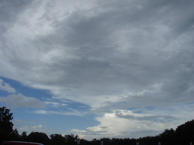
This picture was actually taken by my wife at Brazos Bend State Park. Our original purpose for going there that day was to look at the stars through the 36-inch telescope at the George Observatory, but we were treated to clouds instead. My wife has a good eye and a nice steady hand; she can take a decent picture. These clouds are blowoff from a thunderstorm that passed over the area about 10 minutes prior. When a thunderstorm breaks down, you often get stratocumulus, altocumulus, and cirrus clouds that form from the original thunderstorm.

This one was taken earlier this evening as I was on my way to class. I did do some digital processing to the sky in order to make the clouds pop out more. If you look at the cloud toward the upper left, then move just right and just down, you’ll see the cloud that captured my attention. I wasn’t sure if I was seeing what I thought I was seeing. This would be altocumulus standing lenticular. This cloud, like its cousins in the low and high cloud groups, forms in areas of high wind shear (sudden change in speed and direction of wind). These clouds don’t move, but appear to move as the winds over them cause them to constantly change shape. These clouds are pretty rare over my part of Texas as the shear required to make them often is usually only found near mountainous areas. Pilots normally steer well clear of these clouds because they are indicative of moderate or greater turbulence. Anyway, I wasn’t sure so I decided to monitor the situation. Well, not minutes later, I saw the cloud in the same place but it had a distinct almond shape. I tried to find a suitable place to pull over (I was sitting at a red light when I took this photo), but to no avail. When I got to my destination, the cloud had pretty much dissipated, but I couldn’t wait for it to re-form because I needed to go into my class.

I call this one “The Little Engine That Could”. This was a late evening cumulonimbus that really didn’t stand a chance as the daytime support isn’t there for it. This is a cumulonimbus, but without the characteristic anvil. I was waiting for a left turn at this point and had the camera shooting through my windshield. Since my journeys would be taking me away from the cloud, I didn’t get to see how long it had before it dissipated.
Leave a Reply